
Industrial Forest
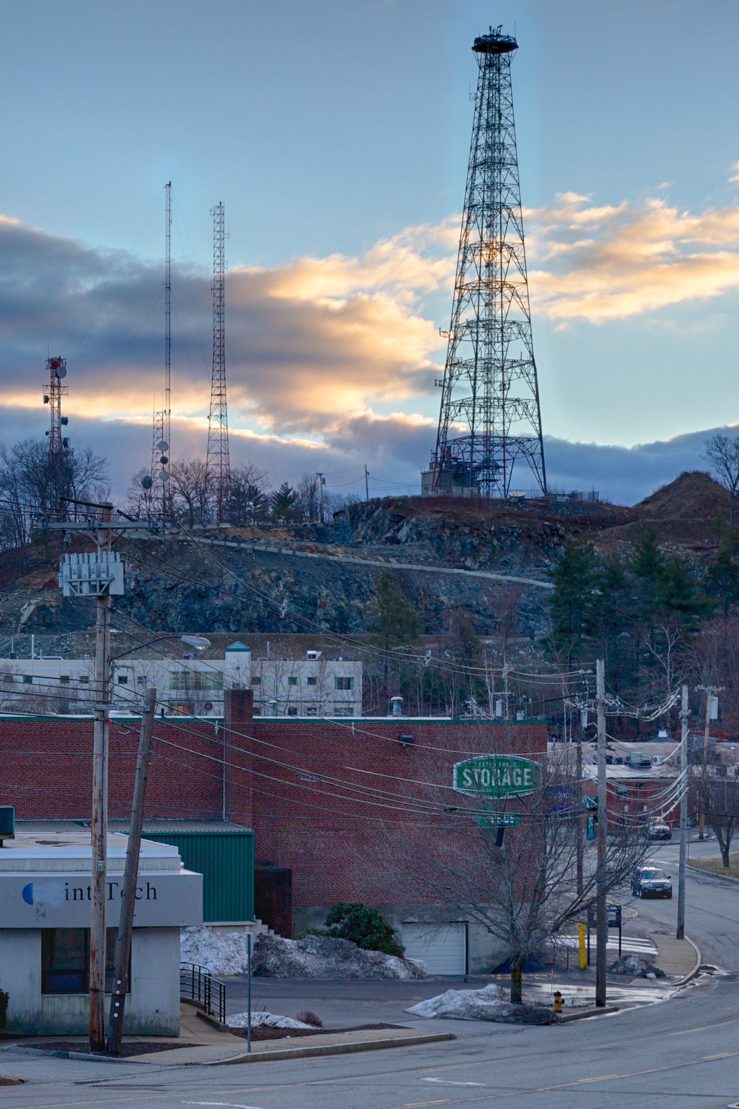
Bear Hill is a small rocky outcrop, rising about 200′ (61 m) above the surrounding landscape, to a height of about 350′ (107 m) above sea level. once forested, it’s now scraped clean, at least at the top and on this side, and perhaps ought to be renamed bare hill. The radio towers and utility line poles lower down do create a technological forest of sorts.
The hill is part of the ring of elevated land that surrounds the relatively flat region containing metro Boston and adjacent cities. This makes it an ideal location for microwave radio dishes, which require an unobstructed line-of-sight. Long before there were cellphones, there were phone company towers here carrying hundreds or thousands of phone lines out of the metro area to the west. Today most of that has moved to underground optical fiber, but the land is still useful for a new generation of radios. In fact, use seems to have expanded in recent years, and that tall tower is relatively new.
Locals may decry the loss of natural beauty, and I can understand that: beautiful isn’t a word that leaps to mind. But to me, this has a rugged appeal of its own. It’s starkly utilitarian, like the adjacent industrial park; a space dedicated to people whose focus is inward, on developing, manufacturing, or selling their products. I’ve worked in industrial parks a number of times over the years, and looking out the window is infrequent even if you have a window with a nice view, and most people here will see the outside only on the way to and from work. Money isn’t wasted on beautifying the buildings or the landscape, because few people will come here who care. The exterior is purely functional and utilitarian. It’s a different environment from a mixed residential/commercial urban one, or even a suburban retail area.
I’m not saying this is a good way to build a work environment. I certainly wouldn’t want to work here. An appealing work environment can contribute to mood, morale, and even productivity, and the outside is part of that environment, particularly if you give people windows, which has also been shown to improve productivity. But like it or not, it’s typical of the way we build many our our exterior spaces today. And my photos are about showing what’s there, not simply the bits we’d like to imagine are the whole. And as I said, I see the stark utilitarianism as having its own kind of appeal.
The buildings seen here are typical of the small industrial parks dotting southern New England, and particularly the western arc of state route 128, now more formally identified as a part of Interstate 95. Some are more nicely landscaped, but many are not. Back in the early days of “high tech” proponents dubbed 128 “America’s Technology Highway” due to the number of computer firms along it. Technology has changed a lot in the last forty years, and the industrial parks have a new generation of tenants who are mostly doing biotech and “Internet” now instead of silicon chips and software. But the character is basically the same. Landscapes like this are as much a part of New England as fishing boats and red barns, and more common than either.
I hadn’t planned this shot, but when I came around the corner and saw the brightly side-lit clouds silhouetting the radio tower I quickly pulled over to take some photos. It was pretty late, and the contrast of the shadowed street against the clouds very extreme, but I was able to get a couple of good photos even so. The clouds were moving quickly, and the interesting light was gone almost as soon as I’d captured it, the very definition of fleeting.
I took this photo mainly for the light, but I like the contrast of the open sky and the very busy collection of buildings and wires of the industrial park below the hill. I also like the way the strong verticals of the utility poles and building edges mirror the verticals of the towers above them.
The image is the usual HDR bracket of five photos at 1 EV offsets. It was taken at ISO 800, with the bracket centered at 1/125th-second, f/11, with the lens at 47mm. I’d put the circular polarizing filter on, but surprisingly it had next to no effect, despite my angle to the sun. The images also had no chromatic aberration, another surprise given the strong light. I basically exported them direct to the HDR software. This was a problematic image for the HDR software though. It was underexposed, and the camera had moved rather significantly between some of my shots. I managed to get one set to process, although not without a bit of haloing in the sky.
I’d also used this to test a new HDR software package, Unified Color’s HDR Expose 3. Unfortunately its de-ghosting wasn’t up to the amount of camera motion, so I ultimately processed the image in my usual Nik Software HDR Efex Pro 2. Expose did a better job on the sky overall, although it also had problems handling the full dynamic range of the images and the building colors. But with the amount of ghosting it showed, the point was moot and I had to use Nik, halos and all. I’ll revisit this software for future HDR and see if I can learn how to overcome its problems, although if it can’t handle ghosting from hand-holding the camera, it’s probably a non-starter for me.

In Ireland I saw a lot of windpower projects. To the native the skyline is ruined, yet the newcomer seeing a line of huge turbines on a mountain ridge may appreciate some techno-beauty, especially at a distance. In any event, Ireland needs power; it has wind and hills….. In Texas I sailed through the Laguna Madre most of one day (~30 miles) and a line of wind turbines was always in sight. I think I was less disturbed that a desert was the site for such a project as opposed to green wooded hills of Ireland, but that is merely my geography bias showing!